| Walking Trails in Historic Concord, Massachusetts |
| Annursnac – Baptist Brook Conservation Land Trail Guide – PDF – Annursnac Hill Concord, Massachusetts. It is the highest point in the town at 361 ft – WikiPedia |
| Thoreau Leave No Trace Trail Guide – PDF – A set of outdoor ethics – WikiPedia |
| Barrett’s Mill Conservation Area Trail Guide – PDF |
| Emerson – Thoreau Amble Trail Guide – PDF – The Emerson Thoreau Amble is a 1.7-mile footpath from Emerson’s house to Walden Pond – Read More |
| October Farm Riverfront Trail Guide – PDF – Wildlife habitat. |
| Old Rifle Range Trail Guide – PDF |
| Reformatory Branch Trail Guide – PDF – A railroad right of way of the Middlesex Central Railroad which opened in 1873 running from Lexington to Bedford and Concord. |
| Rivers Confluence Trail Guide – PDF – “Egg Rock”. |
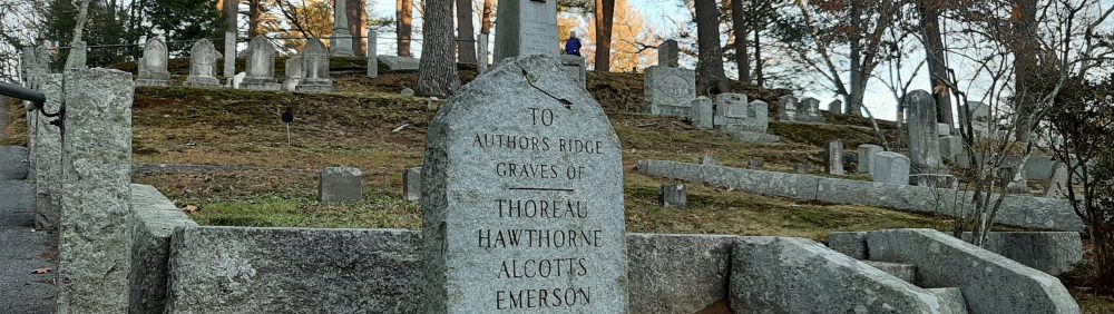
| Sleepy Hollow Cemetery – PDF – A rural cemetery, near the center of Concord, Massachusetts. The burial site of a number of famous authors and thinkers, especially on a hill known as “Authors’ Ridge.” Read More at WikiPedia |
| Westvale-Harrington Trail Guide – PDF – Part of Concord once known in the 19th and early 20th centuries as “Westvale”. |
| White Pond Reservation – PDF – 40 acre pond with well-developed hiking trails. |
| Historic Concord Walking Tour Schedule – Read More |